Pangong Tso Lake, a brackish water lake in Ladakh, is also a high grassland endorheic lake in the Himalayas, with a height of 14,270 feet and a length of 134 kilometers, stretching from Ladakh to China. China accounts for around 60% of the length of the water bodies and is 5 km wide at its widest point. It spans a total area of 604 square kilometers.
Pangong Lake Height
Despite being salty water, Pangong Lake freezes entirely throughout the winter. It is a physically distinct landlocked river basin that is not part of the Indus river basin. The Ramsar Convention is now in the process of designating Pangong Lake in Ladakh, as a wetland of international significance. This will be the convention’s first trans-boundary wetland in South Asia.
Lake Pangong’s eastern end, is in Buddhist Tibet. Pangong Tso was near the southern end of the Johnson Line, a mid-nineteenth-century effort at demarcation between India and China in the Aksai Chin area. The Khurnak Fort is located midway between Pangong Tso and the northern shore of the lake. Since 1952, the Chinese have had control of the Khurnak Fort region. The smaller Spanggur Tso lake is to the south.
Leh to Pangong
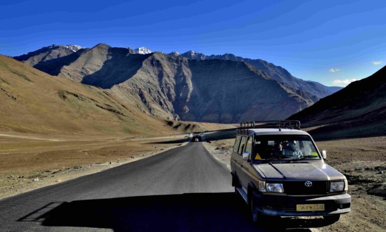
By automobile, the drive from Leh to Pangong Lake takes five hours. The majority of it is on a winding mountain road. The route passes through the settlements of Shey and Gya and passes through Chang La, where travelers are greeted by army sentinels and a tiny tea shop.
The path down from Chang La passes through Tangtse and other minor settlements before crossing the Pagal Naala, or Crazy Stream, river.From May to September, the breathtaking Pangong lakeshore is available to visitors. Because the Pangong Tso lake is located on the Sino-Indian Line of Actual Control, an Inner Line Permit is necessary to access it.

Individual permits are available for Indian natives, but others must travel in groups of at least three individuals with a certified guide. The permits are issued for a minimal charge by the tourism office in Leh. The Indian government prohibits boating for security concerns.
Brackish Water Lake
The Pangong Lake’s brackish water contains relatively little micro-vegetation. According to the guides, except for a few tiny crustaceans, there are no fish or other aquatic life in the lake. Visitors, on the other hand, will see a large number of ducks and gulls flying over and around the lake.
In the wetlands around the lake, there are some scrub and perennial plant species.A variety of species, including a number of migratory birds, use the lake as a nesting habitat. Bar-headed geese and Brahmani ducks are frequently observed here in the summer.
A variety of fauna, including the kiang and marmot, may be found in the area surrounding the lake. Due to natural damming, Pangong Tso used to have an exit to the Shyok River, a tributary of the Indus River, but it was cut off. From the Indian side, two streams feed the lake, generating marshes and wetlands around the borders.
Pangong Tso Lake
A 16-foot deep layer of mud and laminated sand is visible above the current lake level, indicating that the lake has receded lately on a geological scale. There are no fish in the lake, but there are fish in the stream on the south-eastern edge. Poor biodiversity has been attributed to excessive salinity and severe environmental conditions in Pangong.
A series of five linked lakes at an elevation of 14,000 feet is located near the western extremity of Tibet, in a small valley twisting for almost 100 miles from east to west among majestic snowy mountains. The higher lakes, which are fresh and drain from one to the next, are located in Tibetan territory and are poorly known; the lowest and largest lake, Pangong, which has no outlet and is saltwater.

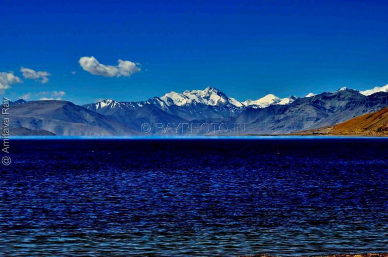
Pangong is located in the Indian district of Ladakh, or Little Tibet, and is visited practically every year by British sportsmen. Professor Ellsworth Huntington visited Pangong from May 1 to 6, 1905, while on his route to Chinese Turkestan as part of the Barrett Expedition to Central Asia. The lake is stunning, a gleaming expanse of the cleanest, darkest blue that shades softly to purple in the shadows and to pure, brilliant green towards the shore.
Ladakh Pangong Lake
According to the author, “spring sharply from smiling blue bays to a height of 1,000 or 2,000 feet, and then, at softer angles, ascend 3,000 to 4,000 feet further to a chain of peaks, 20,000 feet high, snow-capped, and full of glacier tongues.” In terms of verdure, Pangong must match, if not outperform, the most famous lakes in Italy and Switzerland.
The snow had vanished up to a height of 16,000 feet by the time he arrived in early May, and the two inches that had fallen at the lake’s level on May 6 had evaporated quickly. The lowest nighttime temperatures ranged from 21°F to 29°F. The mornings were bright and mild, but between one and three o’clock in the afternoon, a strong west or northwest wind blew, chilly and unpleasant, and occasionally accompanied by sleet squalls.
The few hardly Buddhists of Tibetan stock inhabiting the western shores of the lake were just beginning to sow barley, the only crop that would ripen, and the few hardly Buddhists of Tibetan stock inhabiting the eastern shores of the lake were just beginning to sow barley, the only crop that would ripen.
It is sown in the May frosts and snow and harvested in the September frosts and snow. Barley regularly ripens at the Pangong lake level, at 14,000 feet, but at Pho Brang, a few hundred feet higher, six miles north of the west end of the lake, the crop frequently fails, and the top limit of agriculture is reached not only for this region, but perhaps for the entire world.
The Pangong lake was completely covered in pale-green or steel-blue ice on May 1 and 2, with the exception of some large cracks and a marginal strip 20 to 200 feet wide, where ducks, geese, and gulls fished happily for the majority of the day, though they had to sit despondently for the first hour or two each morning, when even the open strip was frozen.
Pangong Temperature
A severe wind blew from the northwest during the night of May 2. Even though it was 22° F the next morning, the ice had completely vanished from the center of the lake for 8 or 10 kilometers, albeit the ends were still closed. A ridge of ice, 8 or 10 feet high and 30 or 40 feet wide, was built along the beach. It had been pushed onto the slightly sloping shore in big sheets elsewhere, one of which was 15 by 40 feet in size and was 2 to 4 inches thick.
Later, he noticed a thinner sheet approaching the beach. It traveled diagonally across the shore at a rate of 3 feet per minute, as if propelled by an unseen machine, under the impact of the typical strong afternoon breeze from the northwest. As seen in the foreground, the sandy beach was forced into a ridge, and flat stones 8 inches in diameter were readily moved.

The amount of ice thrown onto the beaches did not appear to be enough to account for the entire disappearance. He decided to test it by measuring the saltiness of the water, believing that a change in the lake’s circulation must have occurred. He had sampled the latter on May 1 and 2 at the bay east of Mun and elsewhere, and could barely detect any saltiness; on May 4 and 5, he tasted it again in the same areas, and found it to be so salty that it was undrinkable.
Pangong Lake in Ladakh
The two main lakes, Pangong and Nyak Tso, have a total length of 75 miles and are separated from one another only by an alluvial fan or delta, similar to that seen at Interlink in Switzerland. When covered with water, the entire series may be thought of as a single basin with a length of 105 miles, a maximum width of 4 miles, and an average width of just 1.8 miles.
The basin appears to have formed as a result of glacial erosion, and the lakes, based on their appearance, are similar to the famed Swiss valley lakes. Old moraines show that the basin was once or twice filled with ice prior to the formation of the current lake, while lacustrine deposits and elevated beaches show that the lake level has fluctuated over time in response to climate changes less severe than those that caused the glaciers to invade the basin.

As a result, a record of multiple glacial periods is kept in a location where it is most useful for comparison. The damming of an ancient outlet by fans from tributary torrents is responsible for the glacial formation of the Pangong basin. The former exit, a long U-shaped valley running northwestward from the lake’s western end, is visible, as is the alleged dam.
The massive fan with a radius of 1,500 feet and the lowest point of 90 feet above the lake, located a mile from the latter at the mouth of a tiny river from the south. The fan separates the Indus River from Pangong Lake, although it does not appear to have been the cause of the latter’s development; rather, it appears to have been able to flourish since the earlier stream from the Pangong area stopped flowing.
Courtesy: The Journal of Geology: Vol 14, No 7, pp. 599-617 (Oct-Nov, 1906) ELLSWORTH HUNTINGTON, Milton, Mass. The University of Chicago T&C


Reach pangong lake in a five-hour journey from Leh. Most of it on a rough and dramatic mountain road. The road crosses the villages of Shea and Gya and traverses the Chang la where army sentries and a small tea house greet visitors.