Amitava Ray

Amitava Ray

I'm a photographer (1979), a blogger (2006), and a reference article's author on Wikipedia, enhancing your next assignment with illustrated knowledge before moving on.

Easter Island, aka Rapa Nui
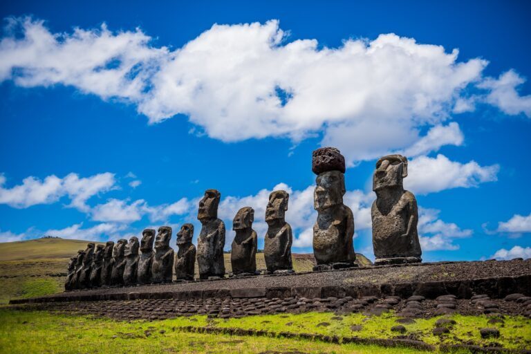
Rapa Nui National Park, Easter Island Chile
Easter Island, also known as Rapa Nui or Isla de Pascua in Spanish, is a Chilean territory located in the remote eastern Pacific Ocean, roughly 2,300 miles west of the Chilean coast and 2,500 miles east of Tahiti. Covering approximately 64 square miles, Easter Island is renowned for its extraordinary stone statues, known as Moai, numbering nearly 900, which were crafted by skilled artisans and engineers. These enigmatic sculptures remain unique in the realm of Polynesian culture. The purpose of these colossal figures and the techniques used to create and transport them continue to be subjects of speculation. This isolated island, the easternmost point of Polynesia, boasts a landscape adorned with these massive stone statues and other archaeological wonders. Easter Island’s history is marked by ecological challenges, including deforestation and resource depletion, which, according to some research, contributed to the decline of the ancient Rapa Nui civilization.
Perito Moreno Glacier

Perito Moreno Glacier of Los Glaciares National Park
Perito Moreno Glacier is in Los Glaciares National Park, situated in the southwest of Argentina's Santa Cruz Province, and has been designated a UNESCO World Heritage Site since 1981. This park is renowned for its natural wonder, the Perito Moreno Glacier, which is among the most captivating attractions in Argentine Patagonia. As one of the 48 glaciers within the Southern Ice Field of Patagonia, the Perito Moreno Glacier ranks among the largest. The sheer size of the Perito Moreno Glacier is awe-inspiring. This glacier spans 3 miles in width and is approximately 700 meters deep at its deepest point, covering an area of 100 square miles. It ranks as the third-largest freshwater source globally, after the Antarctic and Greenland ice sheets. The glacier has been forming for around 18,000 years, with its growth defying the global trend of glacier retreat associated with climate change.

New Lanark

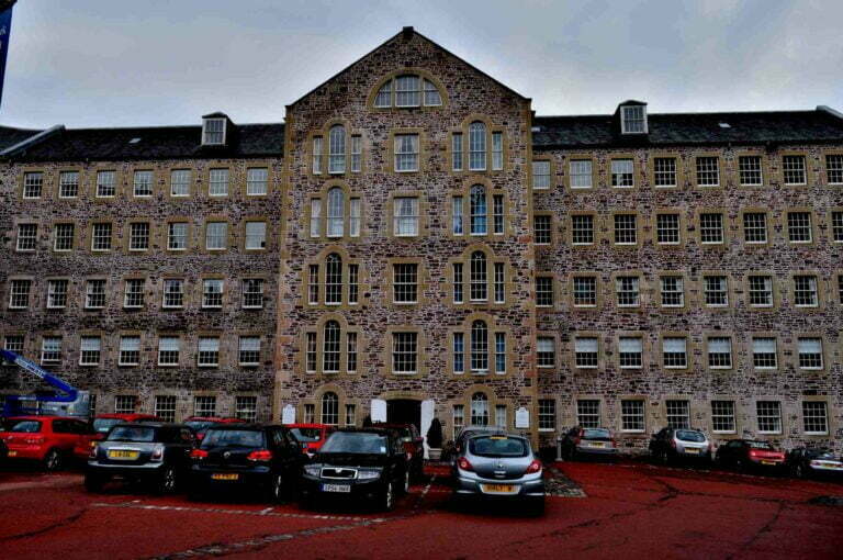
New Lanark, Scotland United Kingdom: England Landmarks
New Lanark is a historic village located in Scotland, near the town of Lanark, UK. The village of New Lanark was established in the late 18th century by David Dale, a Scottish businessman and philanthropist. Dale was a partner of Richard Arkwright, the inventor of the water frame spinning machine, which revolutionized the textile industry. New Lanark became famous for its cotton mills, which were powered by the fast-flowing waters of the River Clyde. In 1786, Dale purchased the land and established the cotton mills, harnessing water power for the production of cotton thread and cloth. The village quickly grew around the mills as workers and their families settled there. The most significant period in New Lanark’s history is associated with Robert Owen, who became the manager of the mills in 1800. Owen was a social reformer and visionary who implemented progressive and groundbreaking ideas for the well-being of the workers and the community.

Ancient Thebes Egypt

Luxor Temple, Ancient Thebes Egypt
Ancient Thebes with its Necropolis, including Luxor, Valley of Kings, Valley of Queens, and Karnak, Egypt, were a UNESCO World Heritage Site from 1979 onwards.

Luxembourg History

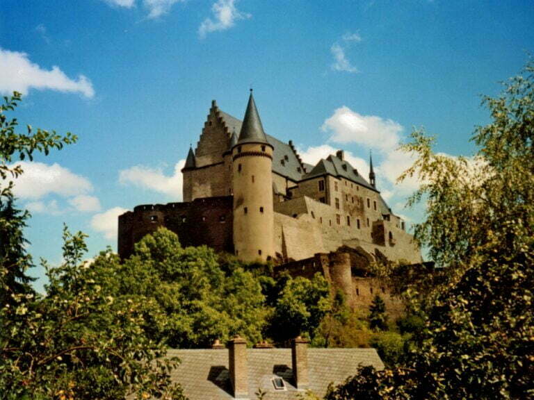
Luxembourg History
Luxembourg customs and traditions, Luxembourg culture facts, and Luxembourg history all originated in Luxembourg City, which became a UNESCO World Heritage Site in 1994.

Poverty Point Louisiana

Poverty Point Louisiana
Poverty Point State Historic Site, located in northeastern Louisiana, holds a unique place in American archaeology. This prehistoric earthwork was constructed by the ancient culture, which extended its influence across the Southeastern Woodlands of the Southern United States and covered a vast territory, spanning 100 miles across the Mississippi Delta and south to the Gulf Coast. The centerpiece of Poverty Point comprises a series of earthen ridges, mounds, and a central plaza, forming a unique geometric design that became apparent through aerial photographs. The six concentric C-shaped ridges, separated by swales, are distinct from Poverty Point. Although the ridges' height and width have been affected by centuries of plowing, archaeologists believe they were once taller and more massive. Radiocarbon dating suggests the ridges were constructed between 1600 and 1300 BCE. The central plaza, encompassed by the innermost ridge, has been significantly modified, with evidence of wooden posts hinting at their integral role in the site. Here's a brief overview of Poverty Point: